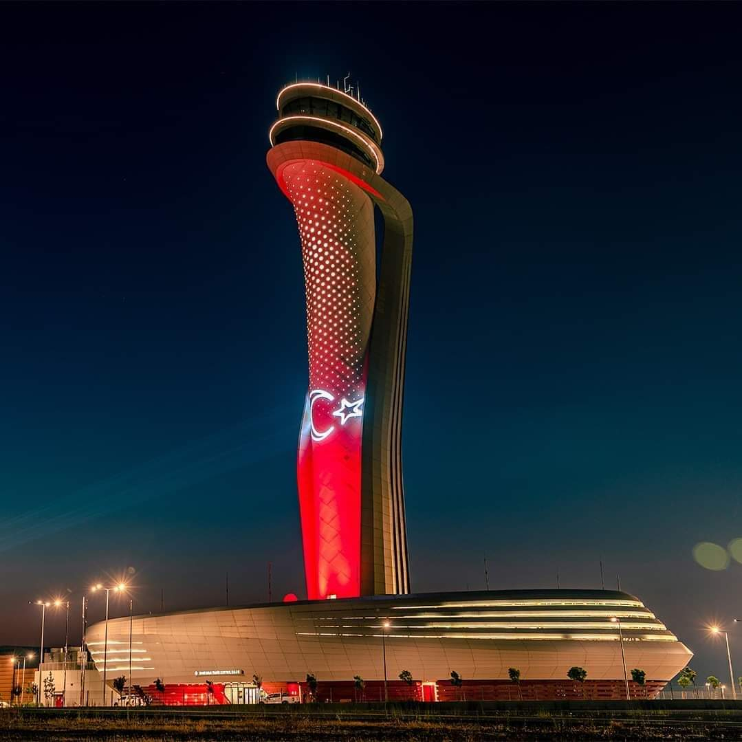
İSTANBUL YİNE ZİRVEDE..MAAŞALLAH
Avrupa'nın en iyi havalimanlarını seçtiler: Zirveye Türkiye çıktı, Almanya ise listeye giremedi
Güncel bir sıralama hangi Avrupa havalimanlarının iyi, hangilerinin kötü olduğunu ortaya koydu. Alman havalimanlarının durumu pek iyi değil. Zirvede ise İstanbul Havalimanı çıktı...
Uzak bir yere tatile gitmeden önce ilk durak genellikle havalimanı oluyor. Ve buradaki deneyim, rahat bir konaklamadan kaosa kadar büyük farklılıklar gösterebiliyor.
Tatil evi portalı Holidu şimdi Avrupa'da hangi havalimanlarının uçak yolcuları tarafından iyi karşılandığını ve hangilerinin karşılanmadığını analiz etti. Google Maps'ten alınan verileri kullanarak ortalama Google puanını ve yorum sayısını karşılaştırdı.
İlk 5'te hangi ülkeler var?
İstanbul Havalimanı'nın zirvede çıkması dikkat çekti. Modern tasarımı, kısa bekleme süreleri, verimli kullanımı, temiz çevresi ve çeşitli alışveriş ve yiyecek içecek seçenekleriyle yüksek puan aldı. İkinci sırada Portekiz'in Porto kentindeki Francisco de Sá Carneiro Havalimanı yer aldı. Burada da kısa bekleme süreleri, personelin güler yüzlülüğü ve şehir merkezine iyi bağlantılar övgüyle karşılandı.
İşte Avrupa'nın en iyi 5 havalimanı
1- İstanbul Havalimanı, Türkiye (Google İncelemesi 4,4) ( 101.956 yorum)
2- Francisco de Sa Carneiro Havaalanı, Porto, Portekiz (Google İncelemesi 4,4) (26.608 yorum)
3- Atina Uluslararası Havaalanı, Yunanistan (Google İncelemesi 4,3) (42.920 yorum)
4- Václav Havel Havaalanı Prag, Çek Cumhuriyeti (Google İncelemesi 4,3) (26.441 yorum)
5- Zürih Havaalanı, İsviçre (Google İncelemesi 4,3) (26.317 yorum)
Alman havalimanları ilk 30'da yok
Alman havalimanları ilk 5 havalimanı arasında yer almıyor. Sadece 30. sırada bir Alman havalimanı yer alıyor. Münih Havalimanı 4.0 Google derecelendirmesi (35,469 yorum) ile. Frankfurt Havalimanı ortalama 3,9 puan ve 65.798 yorumla 40. sırada yer alırken, Stuttgart Havalimanı da 3,9 puan (13.324 yorum) alarak 42. sırada yer alıyor.
Google yorumlarına göre Almanya'nın en kötü havalimanı Berlin Willy-Brandt Uluslararası Havalimanı (BER). Sadece 3,1 ortalama puanla (34.766 yorum) 82. sırada yer alıyor. Sadece Manchester Havalimanı, Bordeaux-Mérignac Havalimanı (Fransa) ve 2,6 puanla son sırada yer alan Girit'teki Heraklion Uluslararası Havalimanı daha kötü olarak değerlendirildi.Haber:Arti49