• May all the praises and thanks be to Allah, to whom belongs all that is in the heavens and in the earth

    Have a blessed Islamic New Year | 1 #Muharram 1447
    May all the praises and thanks be to Allah, to whom belongs all that is in the heavens and in the earth 🤲 Have a blessed Islamic New Year | 1 #Muharram 1447
    0 Commentarios 0 Acciones
  • Why Do Flight Paths Look Curved?

    When flying from *Abu Dhabi to Los Angeles*, you might expect a straight path across the Atlantic or Mediterranean. In reality, the flight takes a curved route over Iran, Russia, the North Pole, and Canada before reaching the US west coast.

    The reason? The Earth is *spherical*, and the shortest distance between two points on a sphere is called a *Great Circle Route*—a curved line on flat maps, but actually the most direct path.

    Flat maps are misleading
    Projections like the *Mercator map* distort distances and shapes. A route that appears curved is actually shorter, while a "straight" line on the map may be longer.

    Why do planes take this route?
    - Shorter distance
    - Less flight time
    - Lower fuel consumption
    - Reduced operating costs
    - Sometimes to catch favorable jet streams

    Ancient knowledge
    Muslim scholars like *Al-Biruni* and *Al-Idrisi* understood Earth's shape and calculated such paths centuries ago for navigation and determining directions.

    So, what looks strange on a flat map is actually the most *efficient and direct path* on our spherical Earth.

    #GreatCircleRoute #FlightPaths #AirTravelFacts
    #GeographyMatters #AviationScience #TravelSmart #CurvedNotCrooked #Map
    ✈️🌍 Why Do Flight Paths Look Curved? When flying from *Abu Dhabi to Los Angeles*, you might expect a straight path across the Atlantic or Mediterranean. In reality, the flight takes a curved route over Iran, Russia, the North Pole, and Canada before reaching the US west coast. The reason? The Earth is *spherical*, and the shortest distance between two points on a sphere is called a *Great Circle Route*—a curved line on flat maps, but actually the most direct path. 🗺️ Flat maps are misleading Projections like the *Mercator map* distort distances and shapes. A route that appears curved is actually shorter, while a "straight" line on the map may be longer. 💡 Why do planes take this route? - Shorter distance - Less flight time - Lower fuel consumption - Reduced operating costs - Sometimes to catch favorable jet streams 📜 Ancient knowledge Muslim scholars like *Al-Biruni* and *Al-Idrisi* understood Earth's shape and calculated such paths centuries ago for navigation and determining directions. 🌐 So, what looks strange on a flat map is actually the most *efficient and direct path* on our spherical Earth. #GreatCircleRoute #FlightPaths #AirTravelFacts #GeographyMatters #AviationScience #TravelSmart #CurvedNotCrooked #Map
    0 Commentarios 0 Acciones
  • Subhan Allah this is a picture for the earth taken from mars
    Allah says " We will show them Our signs in the universe and within themselves until it becomes clear to them that this ˹Quran˺ is the truth. Is it not enough that your Lord is a Witness over all things? " Surah Fussilat 53
    Allah also say " We built the universe with ˹great˺ might, and We are certainly expanding ˹it˺." Surah Adh Dhariyat 47
    and in surah Qaf Allah says " Have they not then looked at the sky above them: how We built it and adorned it ˹with stars˺, leaving it flawless? " Surah Qaf verse 6
    Subhan Allah the only one the creator of everything
    Subhan Allah this is a picture for the earth taken from mars Allah says " We will show them Our signs in the universe and within themselves until it becomes clear to them that this ˹Quran˺ is the truth. Is it not enough that your Lord is a Witness over all things? " Surah Fussilat 53 Allah also say " We built the universe with ˹great˺ might, and We are certainly expanding ˹it˺." Surah Adh Dhariyat 47 and in surah Qaf Allah says " Have they not then looked at the sky above them: how We built it and adorned it ˹with stars˺, leaving it flawless? " Surah Qaf verse 6 Subhan Allah the only one the creator of everything
    0 Commentarios 0 Acciones
  • Fun fact: The Northern point of Brazil is closer to Canada than it is to the most Southern point of Brazil

    Brazil’s landmass spans such vast distances that it defies expectations. Ultimately, it occupies roughly half of South America, covering a total area of more than 8.5 million km2 (3.2 million sq mi).

    To illustrate just how massive it is, Brazil’s northernmost point, Monte Caburaí in Roraima, is closer to Canada than it is to the country’s southernmost point, Arroio Chuí in Rio Grande do Sul.

    The distance between the two farthest points in Brazil is 4,393 km (2,729 mi). But Monte Caburaí is only 4,279 km (2,658 mi) from Canada. The only countries in the world larger are Russia, Canada, China and the United States

    Image: Google Earth
    Fun fact: The Northern point of Brazil is closer to Canada than it is to the most Southern point of Brazil Brazil’s landmass spans such vast distances that it defies expectations. Ultimately, it occupies roughly half of South America, covering a total area of more than 8.5 million km2 (3.2 million sq mi). To illustrate just how massive it is, Brazil’s northernmost point, Monte Caburaí in Roraima, is closer to Canada than it is to the country’s southernmost point, Arroio Chuí in Rio Grande do Sul. The distance between the two farthest points in Brazil is 4,393 km (2,729 mi). But Monte Caburaí is only 4,279 km (2,658 mi) from Canada. The only countries in the world larger are Russia, Canada, China and the United States Image: Google Earth
    0 Commentarios 0 Acciones
  • Burusho people
    ~ They are indigenous to the Lower Hunza Valley in Pakistan. Burushos are one of the last remnants of a pre-Indo-European population in the country. Numbering around 126,000 people, their language Burushaski is unrelated to any language on earth, making it a language isolate.

    The photos are from Photography Club Pakistan, Burusho Museum and X.
    Burusho people ~ They are indigenous to the Lower Hunza Valley in Pakistan. Burushos are one of the last remnants of a pre-Indo-European population in the country. Numbering around 126,000 people, their language Burushaski is unrelated to any language on earth, making it a language isolate. The photos are from Photography Club Pakistan, Burusho Museum and X.
    0 Commentarios 0 Acciones
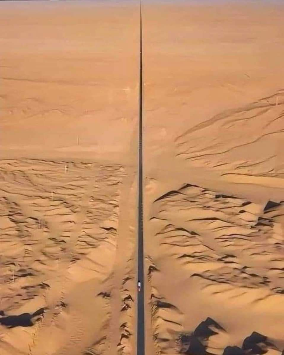
  • Çin'de Ulusal Otoyol 315 olarak da bilinen Qinggan-Gansu çevre yolu, çarpıcı ve sert çölün yüzeyinin Mars’a benzemesi nedeniyle "Mars Yolu" veya "ölüm yolu" olarak anılır.

    Uçsuz bucaksız Gobi Çölü'nden geçen bu rota, Dünya'nın en uzak ve kurak ortamlarından birinde büyüleyici ama bir o kadar da zorlu bir yolculuk sunuyor.

    Gobi Çölü'nün sade, başka dünyaya ait manzarası, onu ekstrem ve istenmeyen bir diyarın simgesi haline getiriyor ve bu ıssız yola cesaret edenlerin hayal gücünü cezbediyor.

    Böyle ıssız uçsuz bucaksız bir çölde araba sürmek sadece cesaret ister..

    Bi de motor sürmeyi düşünün

    The Qinggan-Gansu ring road, also known as National Highway 315 in China, is famously referred to as the "Mars Road" or "road of death" due to its striking and inhospitable desert landscape.

    Traversing the vast Gobi Desert, this route offers a stunning yet challenging journey through one of the most remote and arid environments on Earth. The stark, otherworldly scenery of the Gobi Desert makes it emblematic of an extreme and unwelcoming terrain, capturing the imagination of those who venture along this desolate road.
    Çin'de Ulusal Otoyol 315 olarak da bilinen Qinggan-Gansu çevre yolu, çarpıcı ve sert çölün yüzeyinin Mars’a benzemesi nedeniyle "Mars Yolu" veya "ölüm yolu" olarak anılır. Uçsuz bucaksız Gobi Çölü'nden geçen bu rota, Dünya'nın en uzak ve kurak ortamlarından birinde büyüleyici ama bir o kadar da zorlu bir yolculuk sunuyor. Gobi Çölü'nün sade, başka dünyaya ait manzarası, onu ekstrem ve istenmeyen bir diyarın simgesi haline getiriyor ve bu ıssız yola cesaret edenlerin hayal gücünü cezbediyor. Böyle ıssız uçsuz bucaksız bir çölde araba sürmek sadece cesaret ister.. Bi de motor sürmeyi düşünün 🏍️🛵 The Qinggan-Gansu ring road, also known as National Highway 315 in China, is famously referred to as the "Mars Road" or "road of death" due to its striking and inhospitable desert landscape. Traversing the vast Gobi Desert, this route offers a stunning yet challenging journey through one of the most remote and arid environments on Earth. The stark, otherworldly scenery of the Gobi Desert makes it emblematic of an extreme and unwelcoming terrain, capturing the imagination of those who venture along this desolate road.
    0 Commentarios 0 Acciones
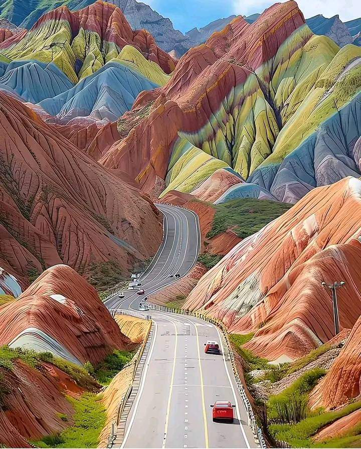
  • Amazing Road And Colourful Mountains In Nevada, USA Never Seen Before On Our Earth July 21,2024
    Amazing Road And Colourful Mountains In Nevada, USA Never Seen Before On Our Earth July 21,2024
    1
    0 Commentarios 0 Acciones
  • Palestinian families in Khan Younis are being displaced into the unknown; there isn’t a single safe meter for them. The humanitarian situation has reached its worst, with people trapped from all sides and not knowing where to flee.

    The Israeli army is committing forced displacement under random shelling and scorched earth tactics.
    Palestinian families in Khan Younis are being displaced into the unknown; there isn’t a single safe meter for them. The humanitarian situation has reached its worst, with people trapped from all sides and not knowing where to flee. The Israeli army is committing forced displacement under random shelling and scorched earth tactics.
    0 Commentarios 0 Acciones
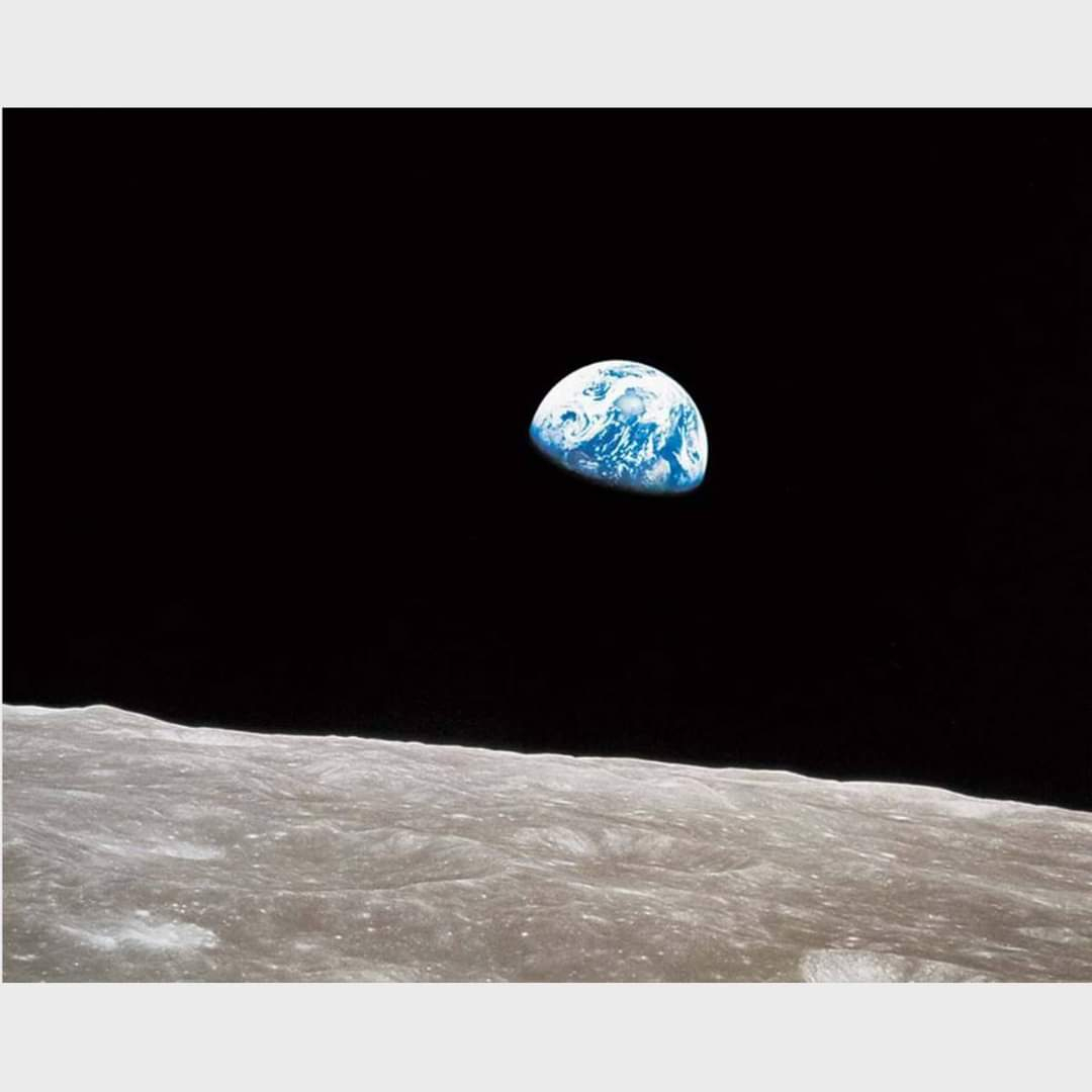
  • Earthrise is a photograph of Earth and part of the Moon's surface that was taken from lunar orbit by astronaut William Anders on December 24, 1968, during the Apollo 8 mission. Nature photographer Galen Rowell described it as "the most influential environmental photograph ever taken". Details are in the first comment.
    Earthrise is a photograph of Earth and part of the Moon's surface that was taken from lunar orbit by astronaut William Anders on December 24, 1968, during the Apollo 8 mission. Nature photographer Galen Rowell described it as "the most influential environmental photograph ever taken". Details are in the first comment.
    0 Commentarios 0 Acciones
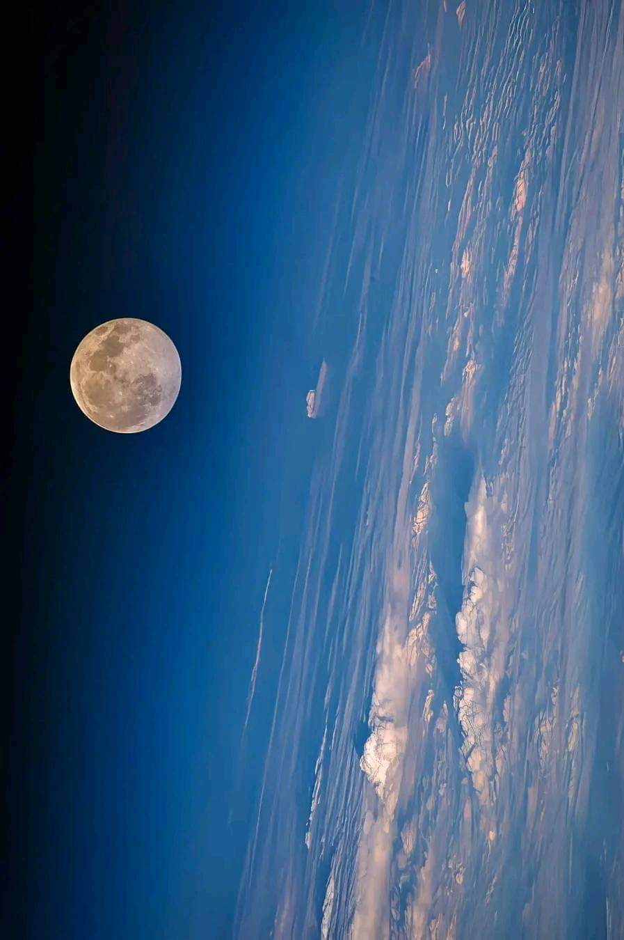
  • The Moon from the International Space Station, through Earth's blue skies.
    The Moon from the International Space Station, through Earth's blue skies.
    0 Commentarios 0 Acciones
Resultados de la búsqueda